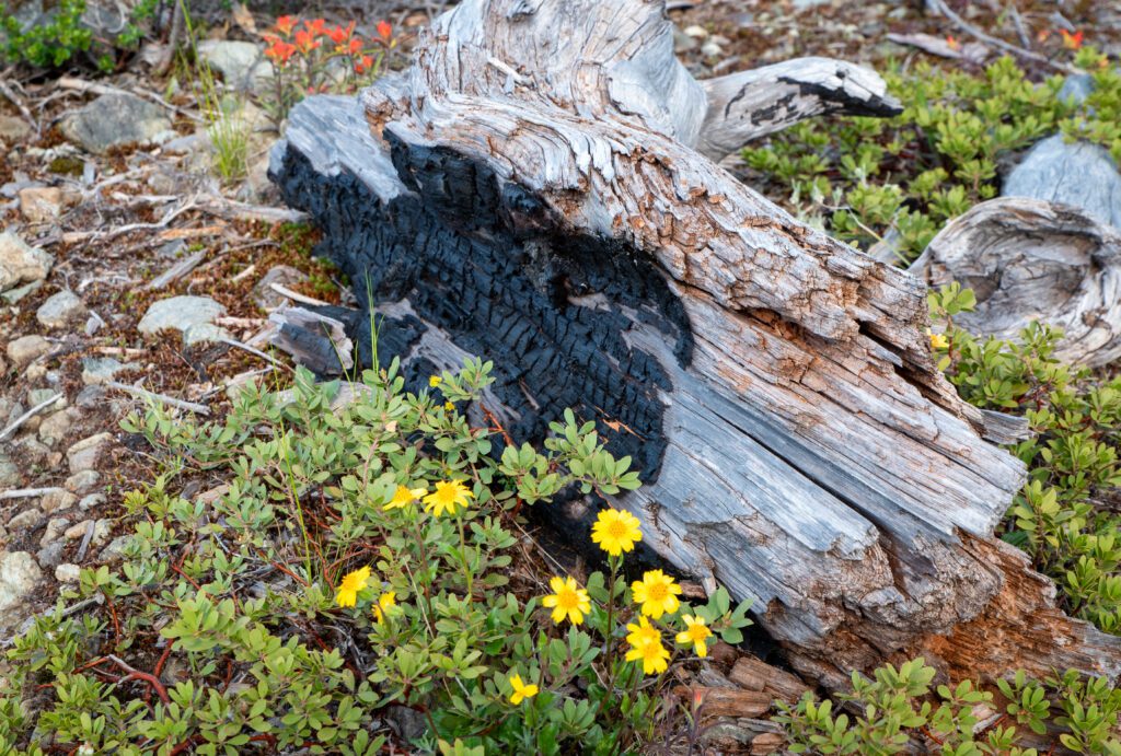
Finding Beauty In Burn Scars


Forests have burned since time immemorial, and fire has played a critical role in the region’s ecology. This natural ebb and flow allows the forest to regenerate, providing a rich mosaic of life on the forest floor. While it can be shocking to see a burn scar, there’s still beauty to be found in the forest’s rebirth. Explore wildflowers and panoramic views throughout Southern Oregon burn scars while getting an up close look at nature’s evolution.
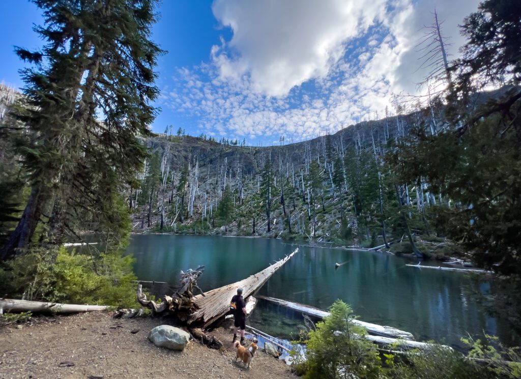
Babyfoot Lake, Kalmiopsis Wilderness
Tucked away in the Kalmiopsis Wilderness, Babyfoot Lake is an Illinois Valley jewel, and one of the most accessible high- elevation lakes in the region. The glacial cirque lake was left behind from the last Ice Age and rises nearly 3,000 feet above the Illinois River. In 2002, the Biscuit Fire became the largest fire in Oregon’s history and burned nearly the entire Kalmiopsis— including the area surrounding Babyfoot Lake.
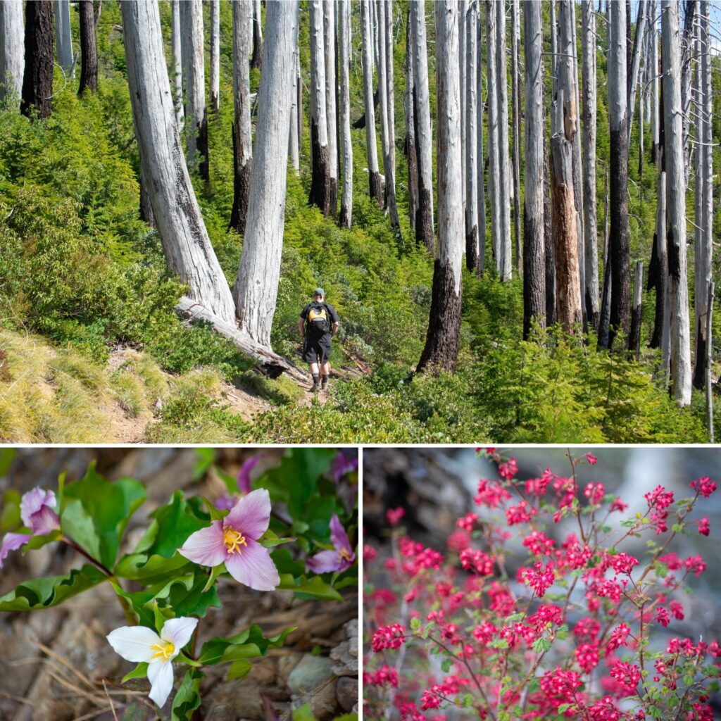 After more than 20 years, hikers will be impressed with the forest’s regeneration, as endemic flowers and bushy greenery carpet the ground. From the trailhead, the easy 1-mile hike to the lake passes panoramic vista points once obscured by the forest canopy as well as colorful trillium, Lewisia cotyledon, and beargrass. Vibrant manzanita juxtaposed with the stark sun-bleached trunks provide a stunning contrast while hiking through the remnants of old growth forest. Approaching the lake, you’ll discover pockets of trees spared from the Biscuit and Chetco Fires, including the rare Brewer’s Spruce and Port Orford Cedars.
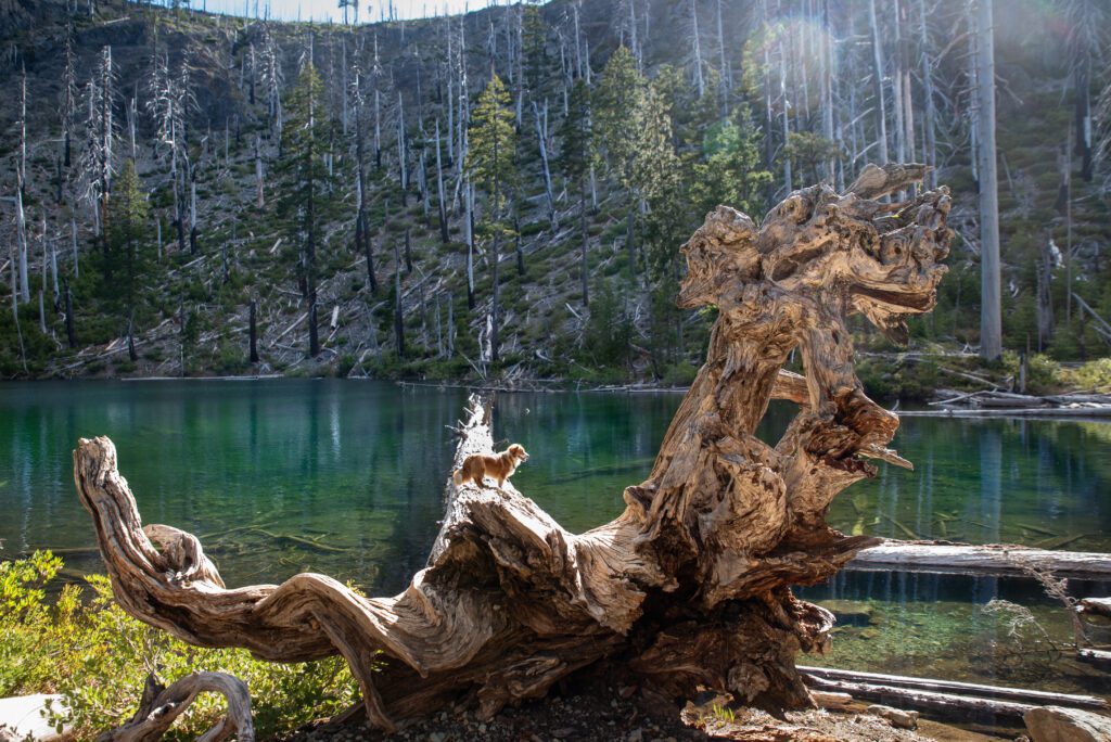 The crystal lake oasis is home to brook trout and gifts hikers a reprieve during summer’s heat. Extend the hike by continuing the trail through the botanical area and along the rim hike that offers a birds-eye vantage point of the lake below. For those who wish to stay the night, there are several places to pitch a tent near the lake’s shore and under the shade of the trees.
 Red Buttes Wilderness
Straddling the Siskiyou Crest and the Applegate/ Klamath River divide, the mountains were named for its fire-toned color, thanks to the region’s red peridotite rock. Popular with backpackers, the 20,000-acre wilderness area is scattered with sub-alpine lakes, rocky buttes, forested ridge lines, and wildflower meadows boasting rare flora. It’s also seen numerous forest fires over the years, where the skeletons of burned trees intermingle with pockets of old-growth firs and cedars. With many routes to choose from, including 35 miles of the Pacific Crest Trail, day hikers and backpackers are afforded solitude and rugged wilderness views along the dozens of trails.
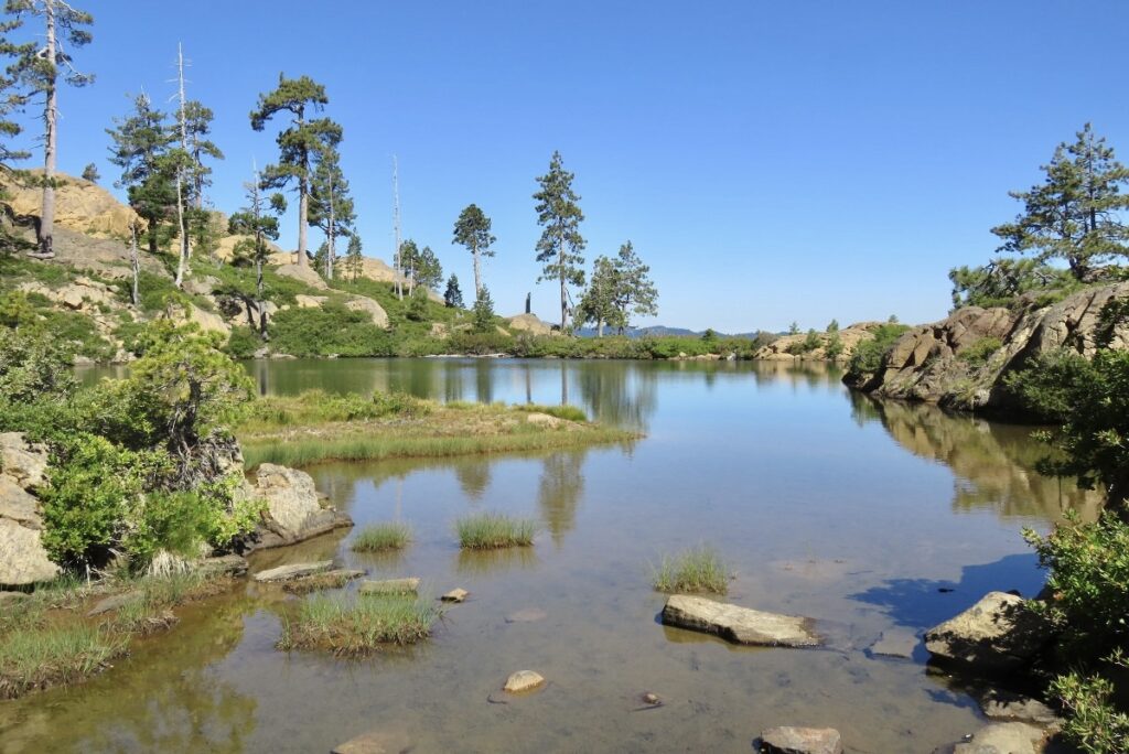
 Bolan Mountain
Located southeast of Cave Junction, Bolan Lake Campground has been a favorite family-friendly retreat during summer months. This high elevation destination offers cooler temperatures and its shoreline is lined with shady old growth trees that eluded the Slater Fire of 2020. Today, the high severity burn areas surrounding Bolan Mountain become a rainbow-colored sea of flowers during June and July.

The fire-induced super blooms are great reminders that something that seems destroyed can still be bursting — and buzzing with life. In addition flowers, bees, butterflies and other pollinators flock to the area. Explore the wildflower strewn scar burns along the Bolan Lake & Mountain Trail, Kings Saddle Trail, or Tanner Lakes Loop Trail nearby. While the fire destroyed the Bolan Mountain Lookout Tower in 2020, officials announced plans to rebuild it this year, so check back soon!
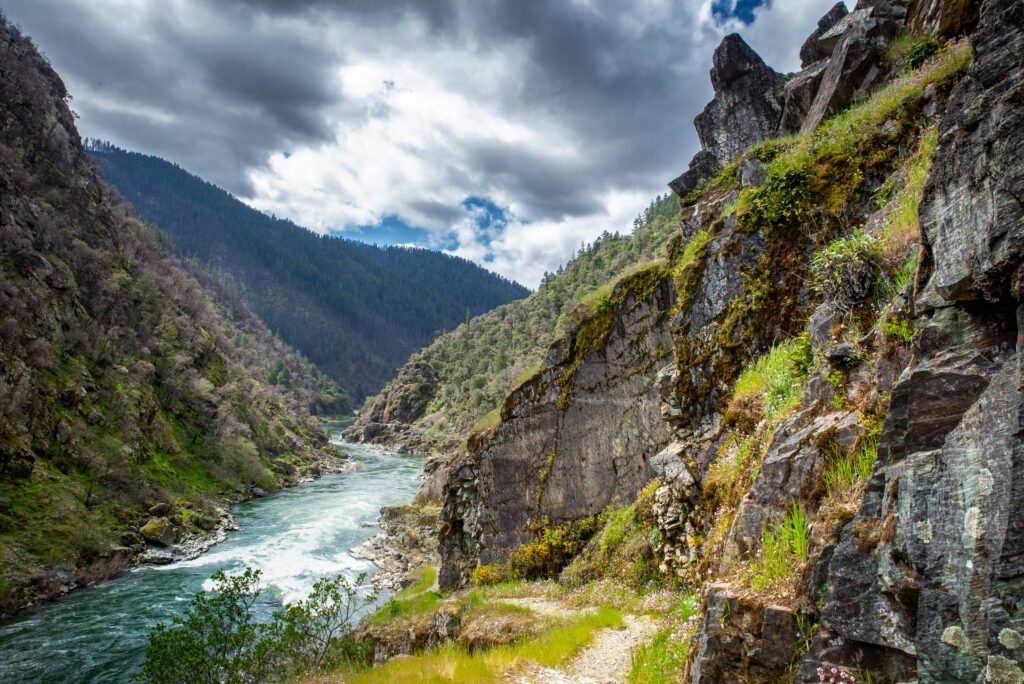 Rogue River Trail
Near Grants Pass, embark on a daytrip or backpacking adventure along the Rogue River Trail, one of Southern Oregon’s most spectacular hikes. After reopening Galice Road this spring since 2022’s Rum Creek Fire closure, the Grave Creek trailhead and boat ramp are easily accessible again.
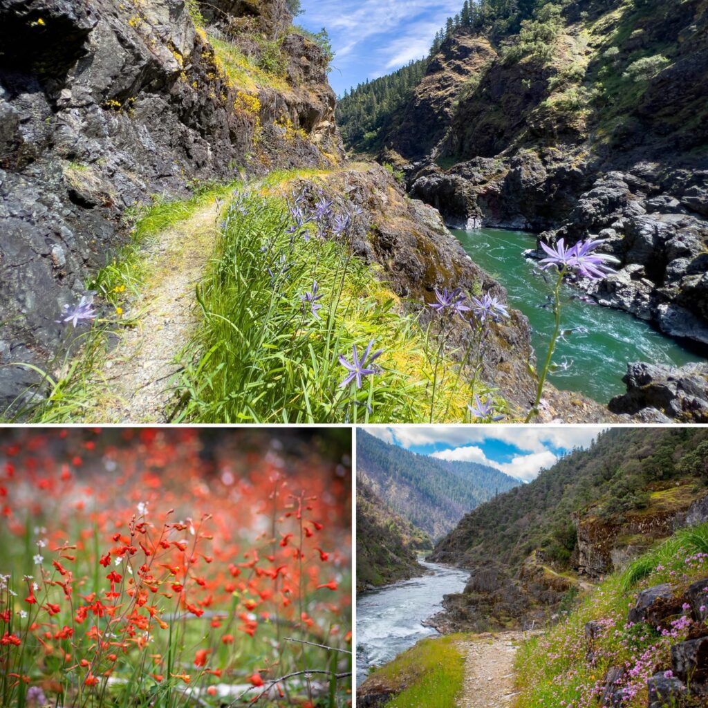 Throughout the nearly 40 mile stretch which follows the Wild and Scenic Rogue River through steep river canyons, old growth forest, and wildflower covered hillsides, pass historic miner cabins and homesteads along the way. During the first 4 miles of the hike, you’ll notice evidence of the Rum Creek fire which burned on the other side of the river, effectively closing the Rainie Falls Trail. Despite the burn scar, the towering mountains that straddle the rushing river below are stunning to see, along with diverse flora that line the rocky walls along the trail.
 Indigenous History and Fire Management
For thousands of years, native tribes including the Takelma utilized anthropogenic fire in Southern Oregon. The controlled burns were used as a tool for food gathering, hunting large game, enhancing plant resources, managing the landscape, and fighting battles. Native women were often responsible for the seasonal burns and would roast and harvest seeds, nuts, camas root, honey, and grasshoppers while deer and elk drives would herd the animals into brush traps. Fires also played an important role in keeping the grasslands and oak savannas healthy, encouraging growth of stronger basket and regalia making materials like beargrass leaves.
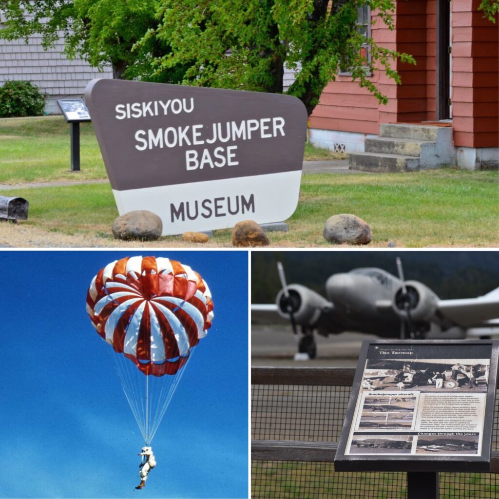 Siskiyou Smoke Jumper Base Museum
While exploring the trails in the Illinois Valley, follow Redwood Highway to the Historic Siskiyou Smoke Jumper Base Museum. During WW2, Japan sent thousands of balloon fire bombs across the Pacific in order to start wildfires on the West Coast. The strategy was to disrupt America’s war effort by causing public panic and reduce resources. In order to combat these attacks, smoke-jumping bases were established in the early 1940s, and one of the first ones built was in Cave Junction, now the home of the Siskiyou Smokejumper Base Museum.
Learn more about hikes and local things to do on our blog!